Knowing your exact position enhances safety, facilitates effective route planning, and enables the ability to respond promptly to unforeseen circumstances and emergencies.
We explore the methods of fixing position ensuring you know exactly where you are. From using traditional tools such as the compass and pencil to the advanced technology provided by satellites, our exploration aims to introduce you to the knowledge and skills needed for precise navigation and avoid the risk of getting lost at sea.
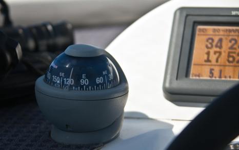
GPS
GPS, short for Global Positioning System, is a satellite-based navigation system offering precise and real-time location information across the globe.
The GPS provides location coordinates of latitude and longitude, which can be plotted directly onto a nautical chart.
Latitude denotes a position north or south of the equator, while longitude specifies a position either east or west from the prime meridian, located in Greenwich, London.

History
Invented by the United States Department of Defense, the first satellite in the GPS constellation was launched in 1978. GPS now consists of a network of satellites orbiting the planet. These satellites continuously broadcast signals that GPS receivers, whether on land, sea, or in the air, can pick up. Through triangulating signals from multiple satellites, GPS receivers pinpoint the user's exact latitude, longitude, and altitude.
Beyond GPS, there exist several other global navigation satellite systems, including GLONASS (Global Navigation Satellite System) operated by Russia, Galileo developed by the European Union, BeiDou Navigation Satellite System operated by China, and NavIC (Navigation with Indian Constellation), an autonomous regional satellite navigation system crafted by India.
Lat & Long
North and South
Latitude is a measure of a location's distance from the equator, an imaginary line encircling the Earth horizontally at its perceived widest point. Serving as the 'baseline' for latitude, the equator is marked at 00 degrees. The north pole is positioned 90 degrees north of the equator, and the south pole is 90 degrees south. These lines of latitude, also known as 'parallels of latitude,' run parallel to the equator.
East and West
Longitude is a measure of how far east or west a location is from the prime meridian, which runs through Greenwich, London. The prime meridian is the 'baseline' for longitude and is marked at 000 degrees. Longitude values range from 180 degrees east to 180 degrees west. Lines of longitude, also called 'meridians,' converge at the poles and are perpendicular to the equator.
A more detailed exploration of degrees involves breaking them down into minutes, with each degree comprising sixty minutes. Each minute is equivalent to a nautical mile, so one degree is sixty nautical miles.
We could then further divide minutes into cables, which are a tenth of a nautical mile, however, for the purpose of this introduction to position fixing, let's presume that as you delve into plotting the specifics, you've already progressed beyond the initial position.
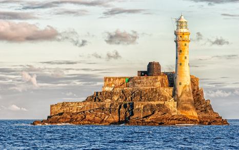
The location of the famous Fastnet Rock situated off the south coast of Ireland is 51° 23' 1'' N and 009° 36' 1'' W.
Breaking down these coordinates, we find that the specified location is 51 degrees north of the equator, with an additional 23 nautical miles and 1 cable (1/10th). Likewise, it is 009 degrees west from the prime meridian, along with a further 36 nautical miles and one cable.
In nautical terms, a degree equals 60 nautical miles. So, the 51° north translates to 3,060 nautical miles, plus the additional 23 minutes resulting in approximately 3,080 nautical miles north of the equator. The westward distance from Greenwich, London is just over 576 nautical miles.
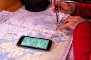
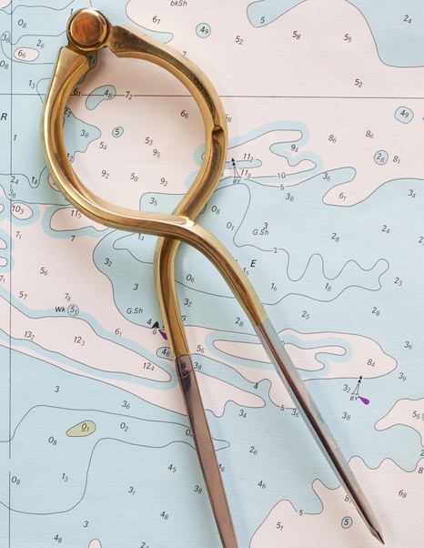
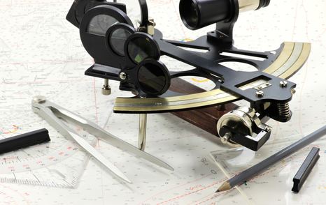
To plot a GPS position on a nautical chart, you will require the essential tools: the appropriate paper chart, a pair of dividers, and a plotting instrument, for example, a Breton or Portland plotter or parallel rules. Oh yes, and a pencil, with a preference for a 2B soft lead. Ensure you have all the necessary items by referring to our 'essential tools' article below.
Essential Tools for Navigation
Plot the line of latitude first, working your way up the scale on the left or right-hand side of the chart. First, find the degrees, then if your position is north of the equator, work your way UP the scale on the side of the chart to pinpoint the minutes. Further breakdowns, including the cables, can be added as desired, but focusing on degrees and minutes will effectively determine your approximate position.
Carefully draw a straight line across the chart based on the scale measurement of your latitude position.
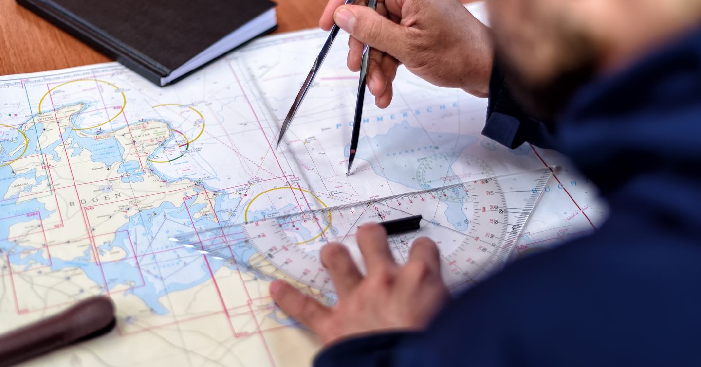
After plotting the latitude, let's move on to the longitude, using the scale at the bottom or top of the chart closest to where you've just drawn your latitude line.
Look for the degrees, and if your position is west of the prime meridian, move to the left on the chart scale. Similarly, if it's east, go to the right. Find the minutes and make any additional breakdowns you need.
Now, draw another straight line on the chart, this time vertically, from the scale measurement of your longitude position, to where it meets the line of latitude drawn previously.
This creates the crosshair of your coordinates, marking your specific location on the nautical chart
Note: Always include the time when charting your position for an accurate and detailed navigation log.
Bearing and Distance
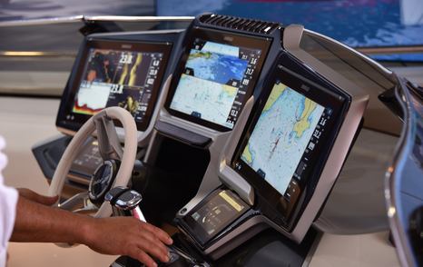
For a quicker way to plot your position, consider establishing a waypoint on the chart and inputting it into your GPS. This allows you to receive real-time updates on your position, including the bearing (direction) and distance to the waypoint.
The official nautical symbol for a waypoint on a nautical chart is a box with a cross through it. However, in our everyday lives, we are more commonly familiar with the symbol on the right.
Opting to set a waypoint on your GPS proves to be a quicker and more user-friendly method than manually plotting your position on a chart, as mentioned earlier. This approach significantly reduces the likelihood of user errors in accurately determining latitude and longitude.
The GPS continually updates in real-time, providing a dynamic bearing towards the established waypoint on the chart. By using the plotter to set that bearing, you can confidently draw a line away from the waypoint. This assures you that your current position lies somewhere along that line.
To gauge the distance to the waypoint, simply employ a pair of dividers and reference the latitude scale on the side of the chart for nautical miles/distance provided by the GPS. Your position is along the line you've just drawn, by the distance set by the dividers.
Charted Objects
When first looking at the detail on a nautical chart it may be a little daunting, however over time you will recognize and become familiar with the intricacies and start to build a picture in your mind of the route you plan to take, noting areas of rough water like overfalls, or areas where rocks and wrecks abound.
Everything marked on a nautical chart serves to enhance your safety at sea. Only objects visible from the sea are included. These may be buildings like churches and lighthouses, or hilltop radio masts, serving as valuable navigational markers.
3-Point Fix
A three-point fix is a navigation method that involves determining your exact position on a chart by intersecting lines of bearing from three distinct and identifiable landmarks, such as the charted objects mentioned earlier.
Identify Landmarks:
Choose three prominent and easily recognizable landmarks that are visible from your current location. These could be lighthouses, prominent hills, or distinct structures like radio masts.
Determine Bearings:
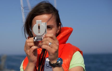
Using a handheld compass, measure the magnetic bearings to each of the three landmarks. Ensure that the bearings are accurate and note the degrees. Ideally take the bearing of the charted object ahead first as this is the bearing that will change the least as you are continually moving.
Plot Bearings on Chart:
On your nautical chart, mark the position of each landmark. From each landmark, draw a line on the chart corresponding to the measured bearing. Repeat this process for the other two landmarks.
Intersection Point: The point where the three lines intersect is your current position on the chart. This is your three-point fix.
Remember to add the time when you make the plot.
Transit
Creating or using a transit is a navigational technique that involves aligning two prominent and visually aligned landmarks, and creating a transit line.
When the navigator keeps the two landmarks in a straight line, they are on the desired course. Or, when the navigator notices that two landmarks will come into line as they travel along a coastline, they can anticipate the transit. At that moment, drawing a line connecting the two landmarks and extending it out to sea provides a reference line on the chart, and noting the time and depth can help establish an approximate position.
When crossing the transit line, a quick reference to the echo sounder for the depth reading can further pinpoint your position. Read more below.
Depth Contours
Depth contours on a nautical chart are lines connecting points of equal underwater depth.
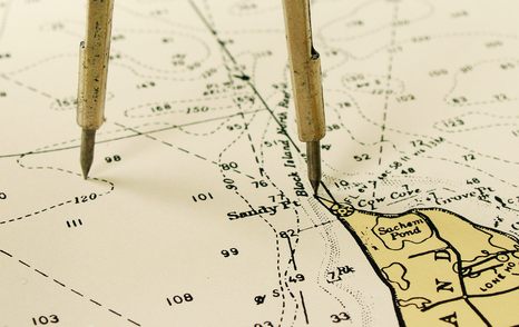
On a nautical chart, the depth contours are depicted as lines, connecting areas with the same depth. Common intervals, such as 5, 10, or 20-meter contours, are usually indicated. Looking closely at the chart image below, you may notice, just to the right near the top of the pair of dividers, the contour lines broken with the numbers 2, 5, and 10. indicating the contour lines of such depths.
The spacing of the contours indicates the steepness or gentleness of the underwater slopes. Closely spaced contours suggest steep terrain, while widely spaced contours indicate a more gradual slope.
Use in Plotting a Position
Depth Reading:
When navigating, take depth readings using the echo sounder. Cross-reference these readings with the depth contours on the chart.
Position Fixing:
You can estimate your position by comparing the observed depth with the charted depth contours. For example, if your depth sounder reads 15 meters, and the 15-meter contour is nearby on the chart, you are likely near that contour.
Navigational Awareness:
Depth contours help you stay in safe waters and avoid underwater hazards. They also aid in route planning, allowing you to follow channels or avoid shallow areas.
Sun, Moon and Stars
Celestial navigation is a traditional method of determining a vessel's position using celestial bodies, primarily the sun, moon, stars, and planets. Navigators use a sextant to measure the angle between the celestial body and the horizon to calculate their latitude and longitude.
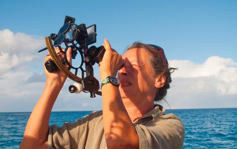
A technique, known as "running fix," involves taking two measurements of the sun at different times, running a known distance between them, and then using the observed changes in position to determine the vessel's course and speed. By comparing the expected and actual positions, navigators can refine their estimates and more accurately pinpoint their current location.
The popularity of celestial navigation experienced a decline with the advent of advanced electronic navigation systems, particularly the Global Positioning System (GPS).
However, concerns about the vulnerability of GPS systems to potential disruptions, whether due to natural events, cyber threats, or geopolitical tensions, have led to a resurgence in interest in celestial navigation.
Being independent of electronic systems, this method of navigation offers a reliable backup and a timeless skill. Navigators have started to appreciate the resilience and self-sufficiency that celestial navigation provides, contributing to its renewed popularity in maritime circles.