It's like reading a map, except that it's called a chart, and it's often what lies beneath the water's surface that poses potential challenges. We explore the basic tools you need to master to stay safe on the water.
Safe navigation requires the knowledge of how to use a few essential tools. Using either traditional or state-of-the-art kit, navigation is the skill of knowing where you are, where you're going, and what you'll find along the way. As technology advances, life on the bridge can be made a whole lot easier, but the basic knowledge is the same. This article looks at each piece of essential navigation equipment and explains how and why they are important.
In this article:
Paper Charts
Passage planning is essential before any trip. At its most basic, it is a visual check of where you are, and where you want to go, with an action plan for between the two. Viewing the passage on a large paper nautical chart can be an extremely satisfying experience and can eliminate many of the user error issues commonly found when using electronic chartplotters.
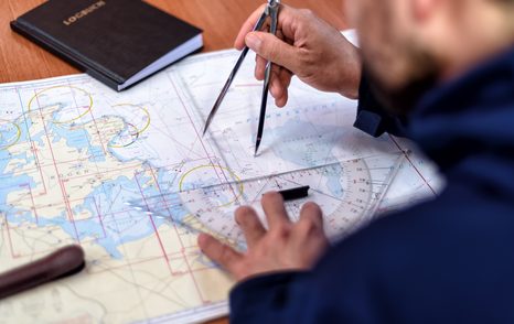
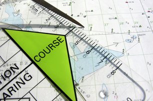
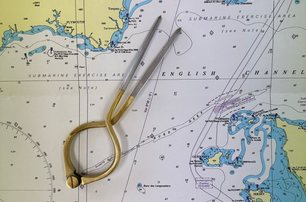
To successfully use a paper chart you’ll ideally have a pair of dividers (a confusing term as it’s actually just one instrument) and a plotter, commonly known as a Portland plotter or Breton plotter. Some navigators use parallel rules, some use a triangle; it's a matter of personal preference.
The dividers are primarily used to measure distances on the nautical chart using the scale of latitude up the side of the chart. Latitude is for measuring north and south of the equator; longitude is for measuring east and west of the Greenwich Meridian, or 000 degrees if you're already in the know.
The plotter is used to provide the bearing, which is the direction of travel that you should steer to, or used to ascertain the bearing of a charted object from your position.
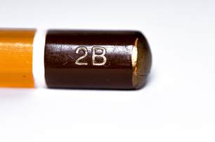
Using a soft lead pencil (2B, or ‘Shakespeare’s pencil’ as fondly known ..”2B or not 2B”) is better for the chart. A pencil sharpener ensures neatness. An eraser for any errors, and to remove previous trips planned on the chart - start with a clean sheet as it were.
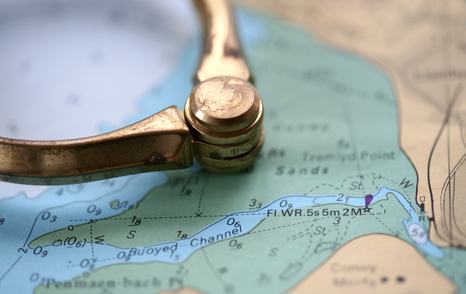
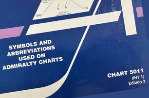
If you would like to know what the obstacles are, there's a handy guide issued by The Admiralty. It's referred to as the 5011, and it's a 'dictionary' of sorts, detailing all the symbols and abbreviations that can be found on nautical charts. Inexpensive and rarely requires updating, every yacht should have one of these handy reference guides near the chart table, or on the bridge.
Passage planning is a legal requirement in many maritime countries. In the event of an accident, you will be expected to present or demonstrate an adequate passage plan to the investigating authorities. Being able to hand them a chart with position fixes and waypoints will be appreciated.
For more information on planning a passage, read our step-by-step practical guide
At YachtBuyer we will keep you updated regarding the intention of the UK Hydrographic Office (UKHO) to phase out the production of paper charts from 2030. Watch this space for updates."
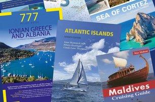
A Nautical Library
To have the correct information onboard to enable informed decisions about the passage ahead, a navigator will require reference books such as almanacs and pilot books.
Almanacs contain a wealth of information about harbors, marinas, tides, regulations, and more, including information to enable well planned pilotage into the final destination. It's useful to keep an up-to-date edition on board as the information is revised annually.
Having a nautical almanac specific to your cruising area is essential for onboard reference. Additionally, a pilot book for the area proves highly useful, providing further detail into the harbour or mooring of your destination."
Where an almanac provides the required information for a large area, a pilot book, often referred to as a cruising guide will focus on a particular area, for example a group of islands, or a specific coastline. A pilot book is the marine equivalent of a Lonely Planet or Rough Guides book covering all the port towns, marinas and anchorages in the area.
Pilot books are a treasure trove of practical advice for navigation, offering insights like recommended anchorages and VHF channels for specific marinas. Both nautical almanacs and pilot books are essential for safely navigating harbors, including guidance on finding leading lights and understanding tidal gauges.
There are many small, specialist publishers around the world that produce regional and local pilot books in various languages. For English speakers, the pre-eminent publisher of these books is Imray, Laurie, Norie & Wilson (Imray.com), based in the UK, which has almost full coverage of the world’s yacht cruising areas and an excellent reputation. Imray is also one of the world’s leading chart agents and can supply all the paper charts you’re likely to need for any area.
For pilot books of the United States, however, the various cruising areas are covered piecemeal by many small, independent publishers. One of the best places to browse and buy pilot books for the US is Bluewater Books (Bluewaterweb.com), based in Fort Lauderdale, Florida, which also supplies an extensive range of paper charts.
Log Book
Correctly maintaining a ship's logbook is not only a legal requirement but also acts as a memento of yachting adventures. This document serves as the vessel's historical record, ensures compliance with international regulations and plays a pivotal role in safety and accountability.
In case of emergencies or accidents, the logbook becomes an invaluable resource for investigators, shedding light on the events leading up to the incident. It also aids navigation, helping mariners monitor course, weather, and any anomalies.
Checklist for the 'traditional' kit:

- Paper chart for the cruising area
- Pair of dividers
- Plotter or parallel rule (or equivalent)
- Soft lead pencil (2B)
- Pencil sharpener
- Eraser
- Admiralty Symbols and Abbreviations (Chart 5011)
- Pilot book or Cruising Guide
- Nautical Almanac
- Logbook
What is GPS?
GPS, or Global Positioning System, is a satellite-based navigation system that enables users to determine their precise geographic location and track their movements anywhere on earth.
The GPS system consists of a constellation of at least 24 satellites (with additional backup satellites) orbiting the earth.

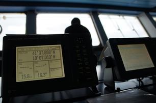
Triangulation: To determine your position at sea, a GPS receiver on the ground calculates the yacht’s distance from at least four GPS satellites. It does this by measuring the time it takes for signals to travel from the satellites to the receiver.
Each GPS satellite continuously broadcasts signals that include information about the satellite's position and a precise timestamp. These signals travel at the speed of light. With distance measurements from the satellites, the yacht's GPS receiver can determine its exact latitude, longitude, altitude, and precise time.
This process is known as trilateration, which is a mathematical technique used to pinpoint a location based on distances from known points.
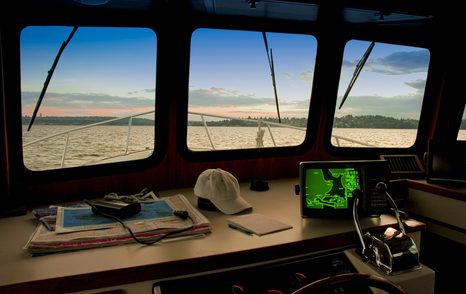
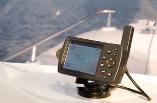
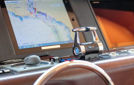
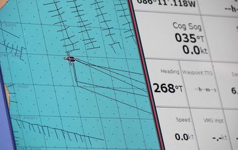
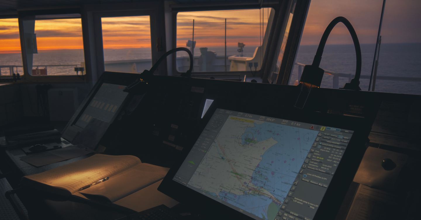
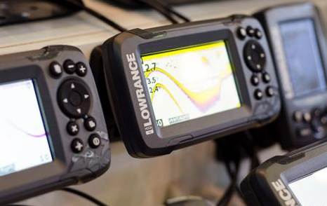
Chartplotter
A Global Positioning System (GPS) electronic chartplotter is now the accepted primary navigation tool onboard most modern yachts. A chartplotter can also be referred to as a Multi-Function Display (MFD), the yachting equivalent of a car’s satnav. It shows the position of the yacht on a nautical chart, from the information provided by the satellites (see article above), displayed on a large touch-screen.
A chartplotter will show the depth of water, shipping lanes, rocks, and other hazards, so by glancing at the screen, and knowing what you're looking at, the navigator can avoid bumping into anything, steer a course away from overfalls and rough water and shouldn't run aground.
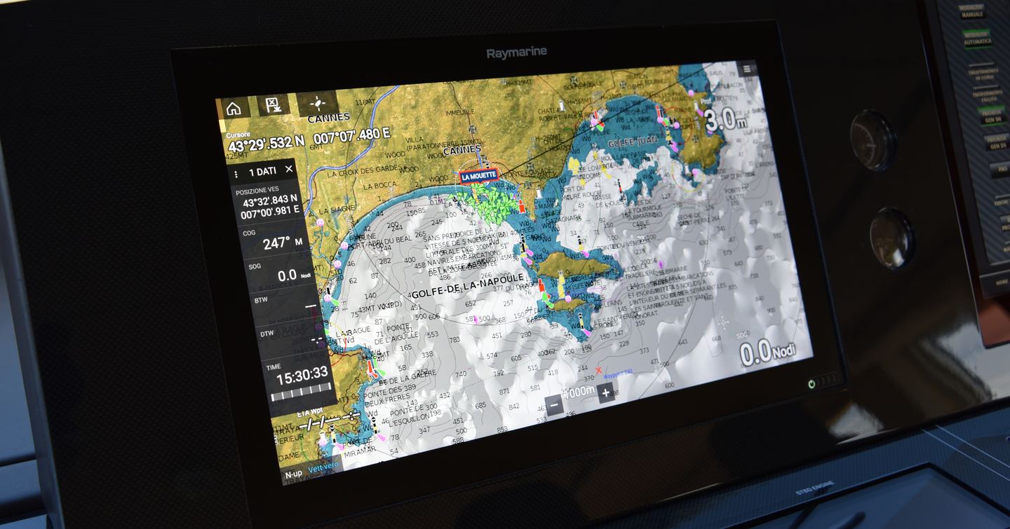
You can also plan a safe route in advance by entering a series of waypoints. The chartplotter will join the dots to make a course (route), and guide you from each waypoint to the next using the GPS information in real time.
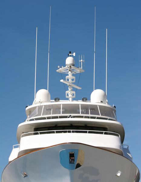
As a display screen, other functions can be added to the chartplotter. This plug-and-play approach means that one screen can show the chart, radar, and sonar information, depending on what transducers (hull fittings) and antennae are fitted.
For a guide to chartplotters/MFD brands, functionality, and buying advice, see our main article on equipping your yacht and our in-depth guide to chartplotters.
Digital Charts
Chartplotters are usually sold with a digital chart that may only cover a small area. To cruise further afield, you will need to invest in the digital nautical charts for your intended cruising area. Digital charts are usually sold on SD or micro-SD cards, which slot into the side of your chartplotter.
There are several suppliers of digital charts, providing national and international coverage. The two most popular, covering great swathes of the world’s oceans and coasts in adequate detail, are Navionics and C-Map.
Both of these offer a choice of digital charts, ranging from relatively basic ones (which have all the essential information you need for safe navigation) to more expensive options with an array of extra layers, views and functions.
Navionics, C-Map and practically all other digital chart brands use exactly the same data to produce their charts. The reliable sources are government run hydrographic offices; the accuracy is identical so your choice of provider is simply a case of personal preference.
Dual Redundancy
Dual redundancy is a fundamental concept in navigation, providing a reliable backup system in case the primary navigation system fails.
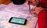
Prudent navigators have a back-up system in case their primary navigation system fails. Your mobile phone is an adequate back-up device for coastal or inland navigation but it is better to have paper charts onboard, or a handheld GPS with spare batteries."
While marine chartplotters are generally reliable when used correctly, they can still crash and depend on the yacht's electrical system. For additional security, chartplotter apps like Navionics Boating on mobile phones or tablets can serve as backup navigation systems. However, they require a phone signal and consume significant battery power, making them less suitable for remote cruising.
The tried-and-true backup method is using paper charts. Even though electronic navigation technology is advancing, paper charts remain a dependable resource so long as the navigator is competent in their use.
When operating electronic navigation equipment, it's important to remember that they are considered secondary aids to navigation. While the use of paper charts may seem nostalgic to some, they provide valuable visual references and can serve as a lifeline if digital systems fail. Paper charts remain the primary aid to navigation. Having the correct paper chart at your chart table is a wise practice, allowing for quick visual checks and the ability to transfer a route in case of digital system failures.
The navigator should enter the yacht’s position, course, speed, weather and other information into the logbook on an hourly basis. The position should then be marked on the chart, with the time. On larger yachts, the logbook may be provided with more detail, such as watchkeeping changeover, engine hours and system checks.
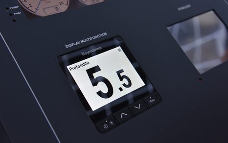
Sounders and Sonar
In their most simple format, which is the focus of this article, an echo sounder, also known as a depth sounder or sonar, accurately measures water depth. The measurement can be set from the yacht’s waterline, or bottom of keel, even including an offset (safety margin) if required.
Echo sounders help ensure safe navigation by providing real-time depth information, allowing mariners to make course adjustments and increase the depth under the keel to avoid potential hazards like shallow areas, submerged obstacles, or grounding.
In terms of situational awareness, echo sounders can be used for navigation in poor visibility conditions or in congested or potentially hazardous waters.
In restricted visibility, a yacht can be navigated along a charted contour line using the sounder as its reference. It’s known as blind navigation and it’s used more often than you’d expect.
For efficient anchoring, knowing the depth of water helps when choosing suitable anchorage spots. The echo sounders will show that there is sufficient depth for the vessel's draft and that the anchor is securely set.
In many maritime regulations and guidelines, yachts are required to carry and use echo sounders as part of their safety equipment to ensure safe navigation and environmental protection.
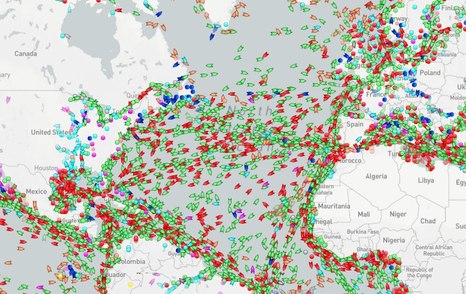
Auto Identification
In the world of yachting, safety and efficient navigation are top priorities. Automatic Identification System, or AIS, is a technology that has quietly revolutionized the way yachts navigate and communicate on the open waters."
AIS is an important tool in the maritime industry, providing vital information for safe and efficient vessel operations while contributing to overall maritime security and environmental monitoring.
AIS provides:
- Vessel Tracking
- Identification
- Collision Avoidance
- Search and Rescue
- Security
- Traffic Management
- Environmental Monitoring
- Fleet Management
- Data for Research
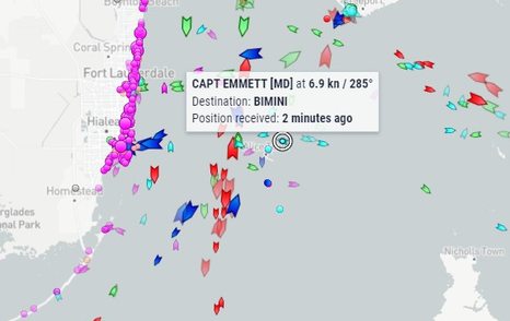
Is it part of the basic navigation kit for a yacht? That's a decision for you, as the yacht owner, based on your yachting lifestyle, navigation requirements of your preferred cruising grounds, budget, and probably a little bit of general interest.
Radar
Radar is the abbreviation for RAdio Detecting And Ranging.
Radar uses radio waves to detect and locate objects, providing information about their position, distance, speed, and direction. Radar information is displayed on a screen or monitor as a visual representation of the surrounding area, with objects appearing as dots, blips, or symbols.
The technology offers an extra pair of eyes on the water, aiding safe navigation, especially in adverse weather conditions and low visibility.
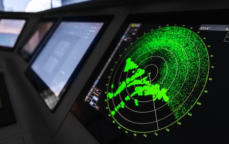
Using radar without proper knowledge and expertise can lead to collision risk and navigational errors.
Misinterpreting radar displays or not understanding how to use radar effectively can lead to the risk of collisions with other vessels. User error includes miscalculating distances, misidentifying landmarks, or misjudging the speed and course of nearby vessels.
Over reliance is another problem with a novice user.
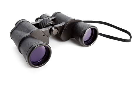
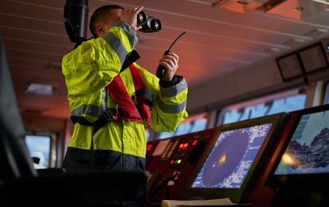
Binoculars
An essential piece of equipment for coastal navigation is a high-quality pair of binoculars. This is almost non-negotiable and investment in a good pair is key. Marine binoculars are distinct with their waterproof and rubber-coated design, offering 7x50 magnification and often featuring an integrated compass for precise bearings on buoys, landmarks, and other vessels.
When navigating near the coast or even out at sea, identifying buoys and beacons that mark safe routes or warn of hazards like rocks or shipwrecks is important.
VHF Radio
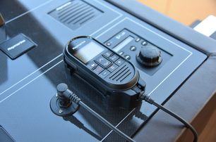
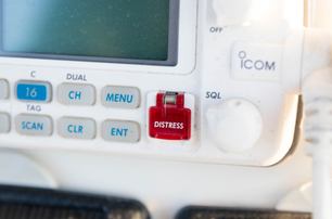
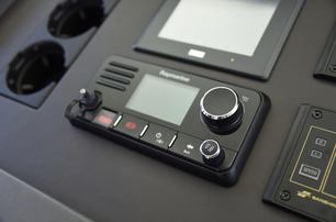
A VHF radio set serves as the cornerstone of effective communication and safety at sea. With its extensive reach and clear transmission capabilities, the VHF radio is an indispensable tool that connects mariners to vital resources, assistance, and crucial weather updates.
When connected to a GPS receiver, many sets display the yacht's position in latitude and longitude.
Summary
- Paper charts and reference books are still the primary aid to navigation - keep a well-stocked library.
- A logbook is mandatory for maintaining accurate records
- A GPS set, either handheld or fixed unit, is an essential secondary aid to navigation
- Chartplotters and digital charts make navigation easy, so long as you know how to use them
- Back up - Have two sources of position information at any one time.
- Stay afloat - Understand the use of the echo sounder
- AIS and Radar - Not essential but useful when trained in its use
- Never underestimate the usefulness of binoculars
- A VHF radio is essential for communications and provides position if linked to a GPS receiver
Further reading